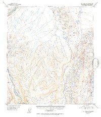
1952 Map of Mt. Hayes D-5
USGS Topo · Published 1952About this map
Delta River and Delta Creek dominate this 1952 topographic study, showing the intricate drainage patterns of the Alaska-Fourth Judicial Division. Surveyed just after World War II using aerial photography from 1949, the map reveals a landscape defined by braided riverbeds and high-elevation glacial runoff. The intricate contour lines trace the ascent toward the mountain peaks, capturing the unpopulated wilderness before significant modern infrastructure reached this interior region. Notable features like Ptarmigan Creek offer precise points of reference for those studying the natural hydrology and topographical changes in the area during the mid-twentieth century.
Find a feature on this map
3 named features on this map. Tap any name to fly to it.
Don’t see what you’re looking for? This feature index may not catch every label — zoom into the map to look around manually.
Map Details
Editions of this 1952 Mt. Hayes D-5 Map
2 editions found

Other maps of this area

1949 · Big Delta A-6
USGS Topo · 1:63,360

1950 · Mount Hayes
USGS Topo · 1:250,000

1950 · Big Delta
USGS Topo · 1:250,000

1950 · Big Delta A-5
USGS Topo · 1:63,360

1950 · Mount Hayes D-4
USGS Topo · 1:63,360

1950 · Mount Hayes C-4
USGS Topo · 1:63,360

1950 · Big Delta A-4
USGS Topo · 1:63,360

1950 · Mount Hayes D-6
USGS Topo · 1:63,360

1950 · Mount Hayes D-5
USGS Topo · 1:63,360

1951 · Big Delta
USGS Topo · 1:250,000