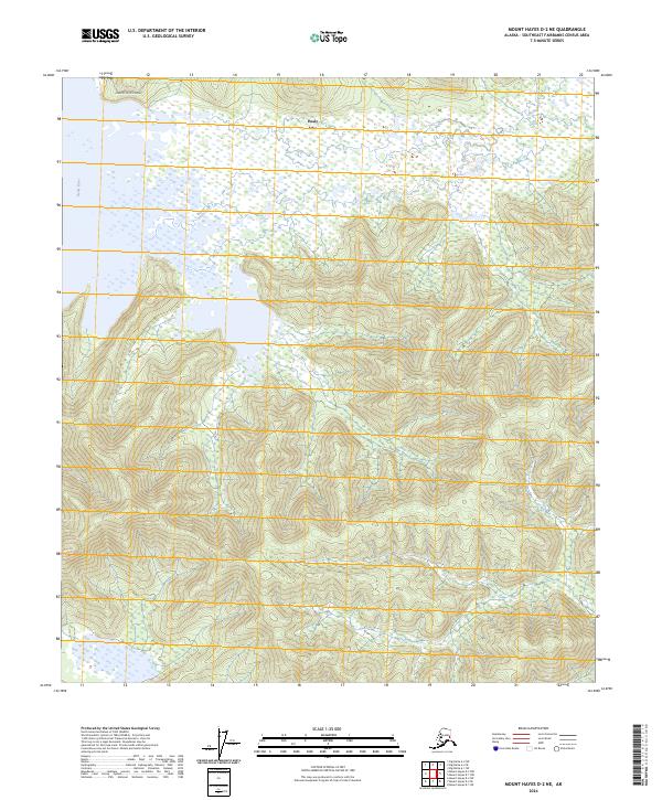
2024 Map of Mount Hayes D-2 NE
USGS Topo · Published 2024About this map
Healy Lake serves as the focal point of this Southeast Fairbanks interior landscape, where the waters meet a complex network of wetlands and varying elevations. The settlement of Healy Lake is situated at the northern edge of the water body, appearing here as a localized cluster of activity within a broader wilderness of surveyed townships. To the northwest, the Healy River winds through the lowlands, while the Landfill Access Road provides a rare point of modern land-based utility in the northern reaches of the quadrangle. This 2024 survey captures the distinct boundary between the water-saturated flats and the increasingly steep terrain that rises to the south, illustrating the natural constraints on development in this portion of the Tanana River valley region.
Find a feature on this map
9 named features on this map. Tap any name to fly to it.
Don’t see what you’re looking for? This feature index may not catch every label — zoom into the map to look around manually.
Map Details
Editions of this 2024 Mount Hayes D-2 NE Map
This is the sole edition of this map. No revisions or reprints were ever made.
Other maps of this area

1950 · Mount Hayes
USGS Topo · 1:250,000

1950 · Big Delta
USGS Topo · 1:250,000

1951 · Big Delta
USGS Topo · 1:250,000

1951 · Mount Hayes
USGS Topo · 1:250,000

1954 · Mount Hayes D-2
USGS Topo · 1:63,360

1954 · Mount Hayes D-1
USGS Topo · 1:63,360

1954 · Big Delta A-2
USGS Topo · 1:63,360

1955 · Big Delta A-1
USGS Topo · 1:63,360

1955 · Big Delta A-2
USGS Topo · 1:63,360

1955 · Mount Hayes D-2
USGS Topo · 1:63,360