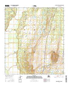
2016 Map of Mount Hayes D-4 SW
USGS Topo · Published 2016About this map
The vast Interior landscape within Fort Greely is defined by a blend of essential infrastructure and distinctive geological formations. Dominating the southeastern portion of the map, Donnelly Dome rises as a prominent landmark above the surrounding lowlands and glacial outwash plains. The Delta River flows along the western edge, carving a path through a terrain marked by numerous small wetlands and kettle lakes. This survey also documents the intersection of critical transport and energy corridors, showing the path of the Alaska Pipeline as it parallels the Richardson Highway through the eastern sections. Local access is provided by primitive routes such as Meadows Road and Fort Greely Ridge Road, which serve the military installation's expansive training areas and remote ridges during the early twenty-first century.
Find a feature on this map
12 named features on this map. Tap any name to fly to it.
Don’t see what you’re looking for? This feature index may not catch every label — zoom into the map to look around manually.
Map Details
Editions of this 2016 Mount Hayes D-4 SW Map
This is the sole edition of this map. No revisions or reprints were ever made.
Other maps of this area

1950 · Mount Hayes
USGS Topo · 1:250,000

1950 · Mount Hayes D-4
USGS Topo · 1:63,360

1950 · Mount Hayes C-4
USGS Topo · 1:63,360

1950 · Mount Hayes D-5
USGS Topo · 1:63,360

1951 · Mount Hayes
USGS Topo · 1:250,000

1951 · Mount Hayes C-5
USGS Topo · 1:63,360

1952 · Mount Hayes D-5
USGS Topo · 1:63,360

1952 · Mount Hayes D-4
USGS Topo · 1:63,360

1952 · Mount Hayes C-4
USGS Topo · 1:63,360

1955 · Mount Hayes
USGS Topo · 1:250,000