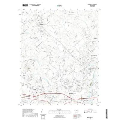
2019 Map of Mount Holly
USGS Topo · Published 2019About this map
The South Fork Catawba River and the Catawba River define this industrial and residential corridor on the border of Gaston and Mecklenburg Counties. This 2019 survey captures the density of small mill towns and suburban developments, showing Mount Holly, Belmont, and McAdenville as they transition into modern hubs while retaining their historical footprints. Genealogists will find a high concentration of burial grounds, including the Belmont Abbey Cem and Christs Lutheran Church Cem, alongside the O'Conner Grove AME Zion Church Cem.
Find a feature on this map
304 named features on this map. Tap any name to fly to it.
Don’t see what you’re looking for? This feature index may not catch every label — zoom into the map to look around manually.
Map Details
Editions of this 2019 Mount Holly Map
This is the sole edition of this map. No revisions or reprints were ever made.
Other maps of this area

1905 · Charlotte
USGS Topo · 1:48,000

1907 · Charlotte
USGS Topo · 1:62,500

1914 · Gastonia
USGS Topo · 1:48,000

1916 · Gastonia
USGS Topo · 1:62,500

1941 · Charlotte
USGS Topo · 1:125,000

1942 · Charlotte
USGS Topo · 1:125,000

1947 · Clover
USGS Topo · 1:62,500

1948 · Paw Creek
USGS Topo · 1:24,000

1948 · Charlotte West
USGS Topo · 1:24,000

1949 · Clover
USGS Topo · 1:62,500