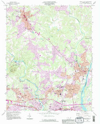
1993 Map of Mount Holly
USGS Topo · Published 1996About this map
The South Fork Catawba River and the main Catawba River frame a landscape defined by North Carolina's industrial and academic expansion in the late twentieth century. In the south, Belmont Abbey College stands as a significant cultural anchor near the Belmont corporate boundary. The map documents the dense suburban growth of the Mount Holly and Stanley areas, while highlighting earlier rural foundations through family landmarks such as Mauney Cem and Springfield Memorial Ch.
Find a feature on this map
98 named features on this map. Tap any name to fly to it.
Don’t see what you’re looking for? This feature index may not catch every label — zoom into the map to look around manually.
Map Details
Editions of this 1993 Mount Holly Map
This is the sole edition of this map. No revisions or reprints were ever made.
Other maps of this area

1905 · Charlotte
USGS Topo · 1:48,000

1907 · Charlotte
USGS Topo · 1:62,500

1914 · Gastonia
USGS Topo · 1:48,000

1916 · Gastonia
USGS Topo · 1:62,500

1941 · Charlotte
USGS Topo · 1:125,000

1942 · Charlotte
USGS Topo · 1:125,000

1947 · Clover
USGS Topo · 1:62,500

1948 · Paw Creek
USGS Topo · 1:24,000

1948 · Charlotte West
USGS Topo · 1:24,000

1949 · Clover
USGS Topo · 1:62,500