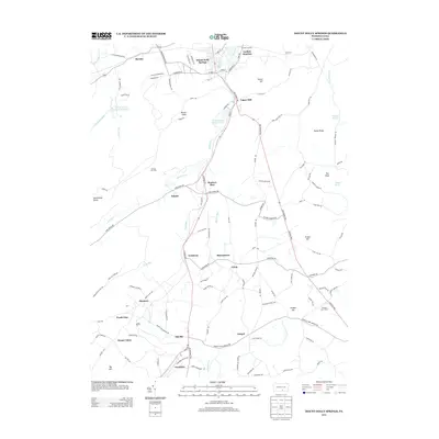
2013 Map of Mount Holly Springs
USGS Topo · Published 2013About this map
Mount Holly Springs sits at the northern edge of this Pennsylvania landscape, where the gap in the mountains facilitates a concentration of historical infrastructure. The area's industrial and agricultural roots are visible through a network of small settlements and named landmarks such as Upper Mill and Carlisle Junction. Water resources are a defining characteristic, with Mountain Creek flowing through the gap to feed Mount Holly Springs Lake and the Mount Holly Springs Reservoir.
Find a feature on this map
120 named features on this map. Tap any name to fly to it.
Don’t see what you’re looking for? This feature index may not catch every label — zoom into the map to look around manually.
Map Details
Editions of this 2013 Mount Holly Springs Map
This is the sole edition of this map. No revisions or reprints were ever made.
Other maps of this area

1904 · Carlisle
USGS Topo · 1:62,500

1908 · Gettysburg
USGS Topo · 1:62,500

1909 · Fairfield
USGS Topo · 1:62,500

1919 · Newville
USGS Topo · 1:62,500

1942 · Gettysburg
USGS Topo · 1:125,000

1943 · Carlisle
USGS Topo · 1:62,500

1944 · Arendtsville
USGS Topo · 1:31,680
1944 · Biglerville
USGS Topo · 1:31,680

1944 · Hampton
USGS Topo · 1:31,680

1945 · Newville
USGS Topo · 1:62,500
Featured Places
- Latimore Township, PA
- Mount Holly Springs, PA
- Gardners, Tyrone Township
- Tyrone Township, PA
- Upper Mill, PA