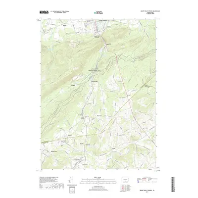
2019 Map of Mount Holly Springs
USGS Topo · Published 2019About this map
Mount Holly Springs sits at the northern end of a valley where Mountain Cr cuts through the ridges of the South Mountain range. This 2019 survey documents a landscape defined by the winding corridor of the Appalachian National Scenic Trail as it traverses the wooded uplands between Toland and Hunters Run. The southern portion of the map transitions into the agricultural and orchard lands of northern Adams County, where small crossroads settlements like Idaville, Peach Glen, and Gardners are established along the drainage of Bermudian Cr.
Find a feature on this map
126 named features on this map. Tap any name to fly to it.
Don’t see what you’re looking for? This feature index may not catch every label — zoom into the map to look around manually.
Map Details
Editions of this 2019 Mount Holly Springs Map
This is the sole edition of this map. No revisions or reprints were ever made.
Other maps of this area

1904 · Carlisle
USGS Topo · 1:62,500

1908 · Gettysburg
USGS Topo · 1:62,500

1909 · Fairfield
USGS Topo · 1:62,500

1919 · Newville
USGS Topo · 1:62,500

1942 · Gettysburg
USGS Topo · 1:125,000

1943 · Carlisle
USGS Topo · 1:62,500

1944 · Arendtsville
USGS Topo · 1:31,680
1944 · Biglerville
USGS Topo · 1:31,680

1944 · Hampton
USGS Topo · 1:31,680

1945 · Newville
USGS Topo · 1:62,500
Featured Places
- Latimore Township, PA
- Mount Holly Springs, PA
- Gardners, Tyrone Township
- Tyrone Township, PA
- Upper Mill, PA