1983 Map of Mount Hood
USGS Topo · Published 1983About this map
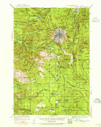
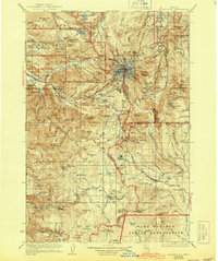
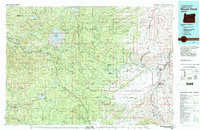
Mount Hood towers over this 1983 topographic survey, which documents the complex transition from the glaciers and alpine peaks of the Mount Hood Wilderness to the arid high desert along the Deschutes River. The map details a landscape managed for both timber and recreation within the Mount Hood National Forest, showing the cluster of settlements along the highway corridor including Rhododendron, Zigzag, and Government Camp. Further south, the Warm Springs Indian Reservation and White River State Game Management Area highlight regional land use patterns of the early 1980s. Traces of pioneer history remain visible via the historic Barlow Road, while modern infrastructure like Timothy Lake and the Union Pacific RR near the Deschutes indicate the vital water and transportation networks of North Central Oregon. Smaller features such as the Bear Springs Ranger Sta and the Rainbow Quarry provide specific points of interest for local historians and researchers.
Find a feature on this map
63 named features on this map. Tap any name to fly to it.
Don’t see what you’re looking for? This feature index may not catch every label — zoom into the map to look around manually.
Map Details
Editions of this 1983 Mount Hood Map
This is the sole edition of this map. No revisions or reprints were ever made.
Historical Maps of Dufur Through Time
3 maps found