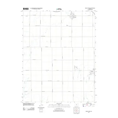
2012 Map of Mount Hope
USGS Topo · Published 2012About this map
Mount Hope serves as the primary hub in this agricultural landscape near the Sedgwick County border, situated along a grid of section-line roads such as W 101st St N and S Ohio St. The town center is marked by its Po and is anchored to the south by the Mount Hope Cem. To the southeast, the smaller community of Andale appears with its own Water Tower and a localized street network including Dale St and Andale Rd. The terrain is defined by the subtle drainage of Rock Cr and Spring Cr, which break the geometric precision of the township roads. Local history is reflected in the placement of cemeteries, including Haven Cem in the northwest corner, and the naming of rural routes like E Pleasant Valley Rd and E Sun City Rd that connect the scattered farmsteads of the Kansas plains.
Find a feature on this map
43 named features on this map. Tap any name to fly to it.
Don’t see what you’re looking for? This feature index may not catch every label — zoom into the map to look around manually.
Map Details
Editions of this 2012 Mount Hope Map
This is the sole edition of this map. No revisions or reprints were ever made.
Other maps of this area

1889 · Cheney
USGS Topo · 1:125,000

1891 · Cheney
USGS Topo · 1:125,000

1901 · Cheney
USGS Topo · 1:125,000

1955 · Wichita
USGS Topo · 1:250,000

1958 · Wichita
USGS Topo · 1:250,000

1958 · Patterson
USGS Topo · 1:24,000
1958 · Bentley
USGS Topo · 1:24,000
1958 · Colwich
USGS Topo · 1:24,000

1959 · Mount Hope
USGS Topo · 1:24,000
1961 · Haven
USGS Topo · 1:24,000