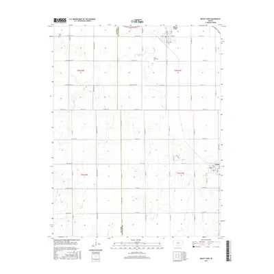
2015 Map of Mount Hope
USGS Topo · Published 2015About this map
Mount Hope and Andale anchor this section of the Kansas prairie, situated along the border of Reno and Sedgwick counties. The landscape is defined by a rigid section-line road grid, including W 101st St N and N 295th St W, which partitions the agricultural terrain between Rock Creek and Spring Creek. This pattern of land use reflects the systematic development of the region's farming economy.
Find a feature on this map
51 named features on this map. Tap any name to fly to it.
Don’t see what you’re looking for? This feature index may not catch every label — zoom into the map to look around manually.
Map Details
Editions of this 2015 Mount Hope Map
This is the sole edition of this map. No revisions or reprints were ever made.
Other maps of this area

1889 · Cheney
USGS Topo · 1:125,000

1891 · Cheney
USGS Topo · 1:125,000

1901 · Cheney
USGS Topo · 1:125,000

1955 · Wichita
USGS Topo · 1:250,000

1958 · Wichita
USGS Topo · 1:250,000

1958 · Patterson
USGS Topo · 1:24,000
1958 · Bentley
USGS Topo · 1:24,000
1958 · Colwich
USGS Topo · 1:24,000

1959 · Mount Hope
USGS Topo · 1:24,000
1961 · Haven
USGS Topo · 1:24,000