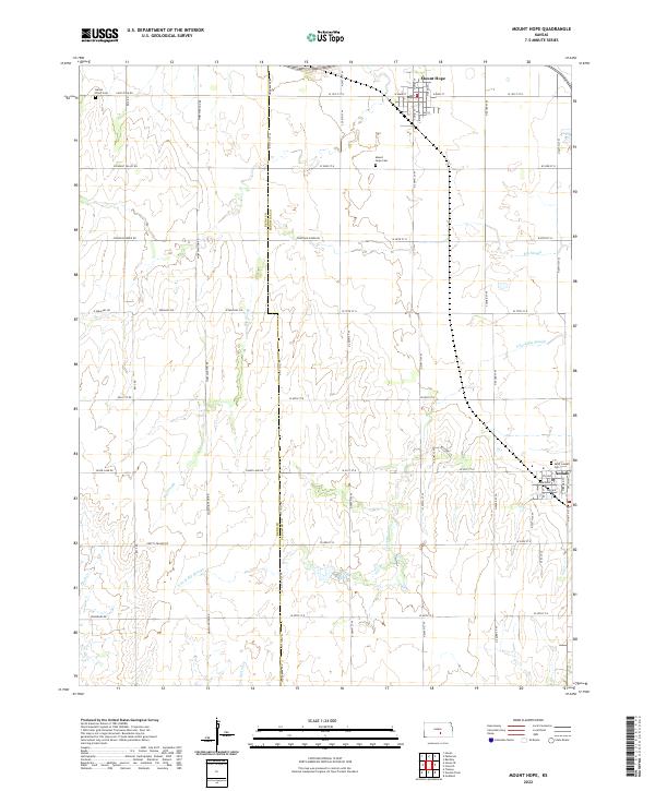
2022 Map of Mount Hope
USGS Topo · Published 2022About this map
Mount Hope and Andale anchor this section of the Kansas plains, marking the boundary where Reno County meets Sedgwick County. The landscape is defined by the gentle drainage of Big Slough and the S Fork Big Slough, which wind through a grid of section-line roads such as Fountain Green Rd and Silver Lake Rd. This survey highlights the spatial organization of these agricultural communities, centered around their local centers of worship and remembrance. Local genealogy researchers will find several significant burial grounds, including Mount Hope Cem and Saint Joseph Cem near Andale, alongside the smaller Haven Priest Cem in the northwest. The presence of smaller waterways like Rock Cr and Spring Cr underscores the importance of surface water in this expansive prairie environment.
Find a feature on this map
56 named features on this map. Tap any name to fly to it.
Don’t see what you’re looking for? This feature index may not catch every label — zoom into the map to look around manually.
Map Details
Editions of this 2022 Mount Hope Map
This is the sole edition of this map. No revisions or reprints were ever made.
Other maps of this area

1889 · Cheney
USGS Topo · 1:125,000

1891 · Cheney
USGS Topo · 1:125,000

1901 · Cheney
USGS Topo · 1:125,000

1955 · Wichita
USGS Topo · 1:250,000

1958 · Wichita
USGS Topo · 1:250,000

1958 · Patterson
USGS Topo · 1:24,000
1958 · Bentley
USGS Topo · 1:24,000
1958 · Colwich
USGS Topo · 1:24,000

1959 · Mount Hope
USGS Topo · 1:24,000
1961 · Haven
USGS Topo · 1:24,000