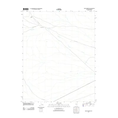
2012 Map of Mount Irish SE
USGS Topo · Published 2012About this map
Logan Canyon and the winding course of Logan Creek define this high-desert drainage system in Lincoln County. This 2012 survey by the U.S. Geological Survey tracks the remote access routes that traverse the arid terrain, including Logan Canyon Rd and the northern junction with Silver Creek Rd. The drainage from Silver Canyon feeds into the larger canyon system, illustrating how water moving through the basin has carved the local landscape over time. Towards the southern edge of the map, Reed Springs Rd provides another point of entry into this unpopulated expanse. The map serves as a record of these persistent desert tracks and the ephemeral watercourses that follow the natural contours of the canyons.
Find a feature on this map
6 named features on this map. Tap any name to fly to it.
Don’t see what you’re looking for? This feature index may not catch every label — zoom into the map to look around manually.
Map Details
Editions of this 2012 Mount Irish SE Map
This is the sole edition of this map. No revisions or reprints were ever made.
Other maps of this area

1945 · Alamo
USGS Topo · 1:125,000

1954 · Caliente
USGS Topo · 1:250,000

1959 · Caliente
USGS Topo · 1:250,000

1969 · Ash Springs
USGS Topo · 1:24,000

1970 · Fossil Peak
USGS Topo · 1:24,000

1970 · Hiko
USGS Topo · 1:24,000
1983 · Crescent Reservoir
USGS Topo · 1:24,000
1983 · Hancock Summit
USGS Topo · 1:24,000

1985 · Pahranagat Range
USGS Topo · 1:100,000

1985 · Mail Summit
USGS Topo · 1:24,000