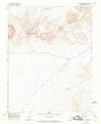
1968 Map of Mount Jackson
USGS Topo · Published 1970About this map
Mount Jackson and the dramatic Jackson Ridge dominate this high-desert terrain in Esmeralda County, as recorded during the late 1960s. The landscape is defined by the broad drainage of Jackson Wash as it descends into the Lida Valley. This environment is marked by sparse human activity concentrated along the main thoroughfare of Route 71. Distinctive markers like Adams Azimuth and a lonely Corral suggest the intersection of scientific survey work and traditional ranching life in this arid basin. Small-scale industrial sites, noted by several Gravel Pit locations, appear alongside the highway, while a Water Tank provides a necessary waypoint for those navigating the valley floor. The map captures a moment when this section of the Great Basin remained largely undeveloped, shaped primarily by its geological features and the passage of travelers between distant mining districts.
Find a feature on this map
11 named features on this map. Tap any name to fly to it.
Don’t see what you’re looking for? This feature index may not catch every label — zoom into the map to look around manually.
Map Details
Editions of this 1968 Mount Jackson Map
2 editions found
Other maps of this area

1908 · Lida
USGS Topo · 1:250,000

1913 · Lida
USGS Topo · 1:250,000

1945 · Goldfield
USGS Topo · 1:125,000

1952 · Goldfield
USGS Topo · 1:62,500

1954 · Goldfield
USGS Topo · 1:250,000

1955 · Goldfield
USGS Topo · 1:250,000

1958 · Goldfield
USGS Topo · 1:250,000

1962 · Goldfield
USGS Topo · 1:250,000

1968 · Lida
USGS Topo · 1:24,000

1968 · Stonewall Pass
USGS Topo · 1:24,000