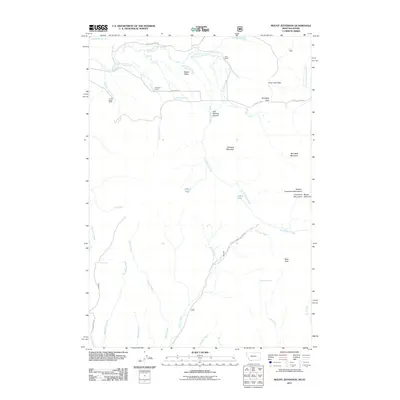
2011 Map of Mount Jefferson
USGS Topo · Published 2011About this map
Holt Ranch and Edwards Ranch sit within a high-elevation ranching landscape at the intersection of the Eastern Centennial Mountains and the Bitterroot Range. This 2011 survey illustrates the complex drainage systems that define the Continental Divide, where Hell Roaring Creek descends through Hell Roaring Canyon toward the Alaska Basin. The terrain is marked by significant peaks such as Nemesis Mountain and Reas Peak, which tower over the alpine waters of Lillian Lake and Blair Lake. Transportation through this steep geography is limited to established corridors like Red Rock Pass Rd, which crosses at Red Rock Pass, and the winding Natl Forest Develop Road 046 Rd. The map also documents isolated agricultural outposts like the Cook Sheep Ranch, demonstrating the persistent presence of livestock operations in this high-country environment.
Find a feature on this map
42 named features on this map. Tap any name to fly to it.
Don’t see what you’re looking for? This feature index may not catch every label — zoom into the map to look around manually.
Map Details
Editions of this 2011 Mount Jefferson Map
This is the sole edition of this map. No revisions or reprints were ever made.
Other maps of this area

1950 · Upper Red Rock Lake
USGS Topo · 1:62,500

1955 · Ashton
USGS Topo · 1:250,000

1958 · Ashton
USGS Topo · 1:250,000

1960 · Ashton
USGS Topo · 1:250,000

1964 · Island Park Dam
USGS Topo · 1:24,000

1964 · Targhee Peak
USGS Topo · 1:24,000

1964 · Sawtell PK
USGS Topo · 1:24,000

1964 · Henrys Lake
USGS Topo · 1:62,500
1965 · Icehouse Creek
USGS Topo · 1:24,000

1965 · Sheridan Reservoir
USGS Topo · 1:24,000