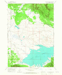
1965 Map of Icehouse Creek
USGS Topo · Published 1967About this map
Island Park Reservoir dominates the southern landscape of this mid-1960s survey, marking a significant hydrologic feature where the waters meet the lower reaches of Shotgun Valley. The terrain is defined by a dense network of mountain drainage, with Icehouse Creek, Sheridan Creek, and Sheep Creek carving through the high country. Much of the northern and southernmost sectors are protected within the Targhee National Forest, where steep timbered slopes give way to the more open, marshy valley floors.
Find a feature on this map
21 named features on this map. Tap any name to fly to it.
Don’t see what you’re looking for? This feature index may not catch every label — zoom into the map to look around manually.
Map Details
Editions of this 1965 Icehouse Creek Map
This is the sole edition of this map. No revisions or reprints were ever made.
Other maps of this area

1950 · Upper Red Rock Lake
USGS Topo · 1:62,500

1955 · Ashton
USGS Topo · 1:250,000

1958 · Ashton
USGS Topo · 1:250,000

1960 · Ashton
USGS Topo · 1:250,000

1964 · Island Park Dam
USGS Topo · 1:24,000

1964 · Sawtell PK
USGS Topo · 1:24,000

1964 · Last Chance
USGS Topo · 1:24,000

1964 · Henrys Lake
USGS Topo · 1:62,500

1965 · Crystal Butte
USGS Topo · 1:24,000
1965 · Bishop Mountain
USGS Topo · 1:24,000