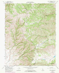
1968 Map of Mount Johnson
USGS Topo · Published 1984About this map
Gabilan Range dominates this landscape along the border of Monterey and San Benito Counties, where steep canyons and high peaks create a complex network of seasonal drainages. The 1968 field check captures a largely undeveloped ranching or conservation area, characterized by family-named terrain like Johnson Canyon, Ben Graves Canyon, and McCoy Creek. The Southern portion of the map transitions into the broader Gloria Valley, featuring Gloria Lake and the small settlement of Chalone. Significant elevation markers such as Mount Johnson and Mount Reynolds tower over isolated flats like Parks Valley and Williamson Valley. The presence of numerous Springs and a Water Tank in this arid environment highlights the importance of water management for the scattered homesteads and livestock reachable only by Shady Lane or remote jeep trails.
Find a feature on this map
47 named features on this map. Tap any name to fly to it.
Don’t see what you’re looking for? This feature index may not catch every label — zoom into the map to look around manually.
Map Details
Editions of this 1968 Mount Johnson Map
3 editions found
Other maps of this area

1910 · Gonzales
USGS Topo · 1:31,680

1910 · Soledad
USGS Topo · 1:31,680

1915 · Soledad
USGS Topo · 1:62,500

1919 · San Benito
USGS Topo · 1:62,500

1921 · Gonzales
USGS Topo · 1:62,500

1921 · Metz
USGS Topo · 1:62,500

1931 · San Benito
USGS Topo · 1:62,500

1940 · Metz
USGS Topo · 1:62,500

1940 · Soledad
USGS Topo · 1:62,500

1940 · San Benito
USGS Topo · 1:62,500