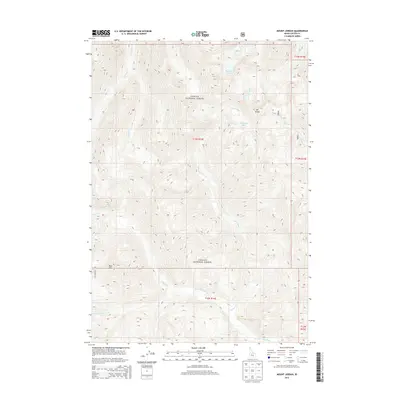
2013 Map of Mount Jordan
USGS Topo · Published 2013About this map
Challis National Forest dominates this high-elevation landscape in Custer County, defined by a network of drainage basins feeding into the W Fork Yankee Fork. The topographic relief is anchored by Mt Jordan in the northeast and Red Mtn to the southwest, creating a complex series of ridges and valleys. Small alpine water bodies including Mystery Lake and Lightning Lake sit tucked within these slopes, serving as the headwaters for several creeks. The map captures the wilderness character of the Salmon River Mountains, where drainage patterns from Pioneer Cr, Tango Cr, and Lightning Cr dictate the natural travel corridors through the forest. The absence of developed settlements highlights the remote nature of this portion of the Challis National Forest during the early 21st century.
Find a feature on this map
18 named features on this map. Tap any name to fly to it.
Don’t see what you’re looking for? This feature index may not catch every label — zoom into the map to look around manually.
Map Details
Editions of this 2013 Mount Jordan Map
This is the sole edition of this map. No revisions or reprints were ever made.
Other maps of this area

1919 · Custer
USGS Topo · 1:125,000

1922 · Custer
USGS Topo · 1:125,000

1930 · Casto
USGS Topo · 1:125,000

1957 · Challis
USGS Topo · 1:250,000

1960 · Challis
USGS Topo · 1:250,000

1963 · Challis
USGS Topo · 1:250,000

1963 · Pinyon Peak
USGS Topo · 1:24,000

1963 · Custer
USGS Topo · 1:24,000

1963 · Casto
USGS Topo · 1:24,000

1963 · Basin Butte
USGS Topo · 1:24,000