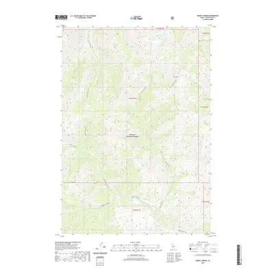
2020 Map of Mount Jordan
USGS Topo · Published 2020About this map
Mt Jordan serves as the literal and figurative centerpiece of this high-altitude landscape within the Challis National Forest. The map documents a complex drainage system where Lightning Cr and Jordan Cr descend from the peaks, feeding into the Westfork Yankee Fork in the southern reaches. This 2020 survey reveals a wilderness defined by water and elevation, noting specialized destinations like Mystery Lake and Lightning Lake that draw modern backcountry explorers. The inclusion of the Crimson Lake Trail suggests the established routes through the Cabin Cr and Cabin Pioneer Creek drainages. While no permanent settlements appear, the presence of specific family or locally named landmarks like Red Mtn and China Cr provides a geographic framework for tracing land-use history and forest management in Custer County.
Find a feature on this map
19 named features on this map. Tap any name to fly to it.
Don’t see what you’re looking for? This feature index may not catch every label — zoom into the map to look around manually.
Map Details
Editions of this 2020 Mount Jordan Map
This is the sole edition of this map. No revisions or reprints were ever made.
Other maps of this area

1919 · Custer
USGS Topo · 1:125,000

1922 · Custer
USGS Topo · 1:125,000

1930 · Casto
USGS Topo · 1:125,000

1957 · Challis
USGS Topo · 1:250,000

1960 · Challis
USGS Topo · 1:250,000

1963 · Challis
USGS Topo · 1:250,000

1963 · Pinyon Peak
USGS Topo · 1:24,000

1963 · Custer
USGS Topo · 1:24,000

1963 · Casto
USGS Topo · 1:24,000

1963 · Basin Butte
USGS Topo · 1:24,000