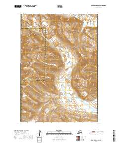
2019 Map of Mount Katmai A-4 SW
USGS Topo · Published 2019About this map
Katmai National Park encompasses the majority of this Alaskan wilderness, where the high peaks of the Kejulik Mountains dominate the northwestern terrain. The landscape is defined by a series of steep drainages, most notably Alagogshak Creek (also labeled Alagogshak Cr), which flows southward through the center of the sheet. To the north, the headwaters of Martin Cr emerge near the high ridgelines. This 2019 survey documents a remote boundary where the Kodiak Island Borough and Lake and Peninsula Borough meet. The map reveals the intricate topographic character of the region, illustrating how the glacial valleys and mountain spurs dictate the flow of the local hydrological network within the protected parklands.
Find a feature on this map
11 named features on this map. Tap any name to fly to it.
Don’t see what you’re looking for? This feature index may not catch every label — zoom into the map to look around manually.
Map Details
Editions of this 2019 Mount Katmai A-4 SW Map
This is the sole edition of this map. No revisions or reprints were ever made.
Other maps of this area

1948 · Mt Katmai
USGS Topo · 1:250,000

1951 · Mt Katmai
USGS Topo · 1:250,000

1951 · Karluk
USGS Topo · 1:250,000

1951 · Karluk D-4
USGS Topo · 1:63,360

1951 · Mount Katmai A-4
USGS Topo · 1:63,360

1951 · Karluk D-5
USGS Topo · 1:63,360

1951 · Mount Katmai A-5
USGS Topo · 1:63,360

1952 · Karluk
USGS Topo · 1:250,000

1964 · Mt. Katmai
USGS Topo · 1:250,000

1964 · Karluk
USGS Topo · 1:250,000