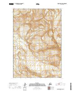
2019 Map of Mount Katmai B-2 NW
USGS Topo · Published 2019About this map
Katmai National Park encompasses this entire terrain, which is defined by high-elevation glacial activity and remote water systems. The eastern portion of the quadrangle is dominated by the massive reach of Hook Glacier, while the southern boundary follows the intricate path of the Serpent Tongue Glacier. These massive ice bodies serve as the primary hydrologic drivers for the region, feeding the headwaters of the Rainbow River as it winds through the southwestern corner of the map. The landscape here is captured in its modern state, reflecting contemporary glacial margins and drainage patterns. Because this area is part of a protected national preserve, the map shows a landscape devoid of human infrastructure or settlements, focusing instead on the dramatic natural elevation changes and the specific boundaries of the township and range lines.
Find a feature on this map
12 named features on this map. Tap any name to fly to it.
Don’t see what you’re looking for? This feature index may not catch every label — zoom into the map to look around manually.
Map Details
Editions of this 2019 Mount Katmai B-2 NW Map
This is the sole edition of this map. No revisions or reprints were ever made.
Other maps of this area

1948 · Mt Katmai
USGS Topo · 1:250,000

1951 · Mt Katmai
USGS Topo · 1:250,000

1951 · Mount Katmai C-3
USGS Topo · 1:63,360

1951 · Mount Katmai C-2
USGS Topo · 1:63,360

1951 · Mount Katmai B-3
USGS Topo · 1:63,360

1951 · Mount Katmai B-2
USGS Topo · 1:63,360
1953 · Mount Katmai C-2
USGS Topo · 1:63,360

1964 · Mt. Katmai
USGS Topo · 1:250,000
2019 · Mount Katmai B-3 SE
USGS Topo · 1:25,000
2019 · Mount Katmai C-2 SW
USGS Topo · 1:25,000