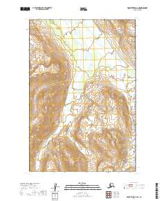
2019 Map of Mount Katmai B-3 NE
USGS Topo · Published 2019About this map
Katmai National Park defines this corner of the Alaska Peninsula, where the landscape is marked by a complex network of glacial valleys and steep ridgelines. The Rainbow River flows through the eastern portion of the terrain, carving a path between significant elevations that reach well over 3,000 feet. This 2019 survey illustrates the dramatic topography of the Lake and Peninsula Borough, documenting the specific township and range boundaries including t20s r33w and t21s r33w. The map provides a precise record of the hydrological patterns and elevation contours in this protected wilderness area, serving as a baseline for environmental study and geographical research in one of the most secluded regions of the American northwest.
Find a feature on this map
8 named features on this map. Tap any name to fly to it.
Don’t see what you’re looking for? This feature index may not catch every label — zoom into the map to look around manually.
Map Details
Editions of this 2019 Mount Katmai B-3 NE Map
This is the sole edition of this map. No revisions or reprints were ever made.
Other maps of this area

1948 · Mt Katmai
USGS Topo · 1:250,000

1951 · Mt Katmai
USGS Topo · 1:250,000

1951 · Mount Katmai C-3
USGS Topo · 1:63,360

1951 · Mount Katmai C-2
USGS Topo · 1:63,360

1951 · Mount Katmai B-3
USGS Topo · 1:63,360

1951 · Mount Katmai B-2
USGS Topo · 1:63,360
1953 · Mount Katmai C-2
USGS Topo · 1:63,360

1964 · Mt. Katmai
USGS Topo · 1:250,000
2019 · Mount Katmai B-3 SE
USGS Topo · 1:25,000
2019 · Mount Katmai B-2 NW
USGS Topo · 1:25,000