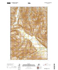
2019 Map of Mount Katmai C-1 NE
USGS Topo · Published 2019About this map
Katmai National Park encompasses a significant portion of this terrain, where the northern reaches of the Kenai Peninsula Borough and Kodiak Island Borough boundary intersect. The landscape is defined by the winding course of the Big River as it traverses the southern sections of the quadrangle. This 2019 survey documents the intricate topographic contours and hydrography of the region during a period of modern conservation and geographic management. The absence of developed roads or settlements highlights the wilderness character of the area, typical of the protected lands within the Katmai National Park system. Researchers can examine the specific township and range lines, such as t17s r29w and t18s r29w, to understand the precise cadastral framework overlying this remote Alaskan environment.
Find a feature on this map
9 named features on this map. Tap any name to fly to it.
Don’t see what you’re looking for? This feature index may not catch every label — zoom into the map to look around manually.
Map Details
Editions of this 2019 Mount Katmai C-1 NE Map
This is the sole edition of this map. No revisions or reprints were ever made.
Other maps of this area

1948 · Mt Katmai
USGS Topo · 1:250,000

1951 · Mt Katmai
USGS Topo · 1:250,000

1951 · Afognak C-6
USGS Topo · 1:63,360

1951 · Mount Katmai D-1
USGS Topo · 1:63,360

1951 · Mount Katmai C-1
USGS Topo · 1:63,360

1951 · Afognak D-6
USGS Topo · 1:63,360

1952 · Afognak
USGS Topo · 1:250,000
1953 · Mount Katmai D-1
USGS Topo · 1:63,360

1964 · Mt. Katmai
USGS Topo · 1:250,000
1983 · Afognak D-6
USGS Topo · 1:63,360