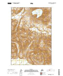
2019 Map of Mount Katmai C-1 SE
USGS Topo · Published 2019About this map
Katmai National Park encompasses this entire Alaskan landscape, characterized by dramatic elevation changes and volcanic features. The most prominent landmark is the Kaguyak Crater in the northeastern section, a significant geological depression holding a large body of water. The topography is defined by sharp contour lines that trace the steep ascent from the lower drainage of the Big River in the west toward the high volcanic peaks. This 2019 survey documents the area as a protected wilderness, devoid of roads or modern settlements, reflecting the primary mission of conservation within the park boundaries. The map provides a precise record of the shoreline and elevation for researchers studying the volcanic arc of the Alaska Peninsula.
Find a feature on this map
7 named features on this map. Tap any name to fly to it.
Don’t see what you’re looking for? This feature index may not catch every label — zoom into the map to look around manually.
Map Details
Editions of this 2019 Mount Katmai C-1 SE Map
This is the sole edition of this map. No revisions or reprints were ever made.
Other maps of this area

1948 · Mt Katmai
USGS Topo · 1:250,000

1951 · Mt Katmai
USGS Topo · 1:250,000

1951 · Afognak C-6
USGS Topo · 1:63,360

1951 · Mount Katmai C-1
USGS Topo · 1:63,360

1951 · Mount Katmai B-1
USGS Topo · 1:63,360

1952 · Afognak
USGS Topo · 1:250,000

1964 · Mt. Katmai
USGS Topo · 1:250,000
2019 · Mount Katmai C-1 NE
USGS Topo · 1:25,000
2019 · Mount Katmai C-1 SW
USGS Topo · 1:25,000
2019 · Mount Katmai B-1 NW
USGS Topo · 1:25,000