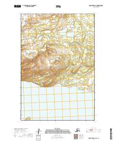
2019 Map of Mount Katmai C-6 NE
USGS Topo · Published 2019About this map
Katmai National Park encompasses the central portion of this landscape, where the inland terrain descends toward the southern shoreline. This 2019 survey illustrates a transition from the elevated contours of the interior down to the vast expanse of Naknek Lake, which dominates the southern half of the quadrangle. The map highlights the interplay between the protected wilderness areas and the large freshwater system, providing a clear record of the shoreline and elevation patterns within the Lake and Peninsula borough.
Find a feature on this map
8 named features on this map. Tap any name to fly to it.
Don’t see what you’re looking for? This feature index may not catch every label — zoom into the map to look around manually.
Map Details
Editions of this 2019 Mount Katmai C-6 NE Map
This is the sole edition of this map. No revisions or reprints were ever made.
Other maps of this area

1948 · Mt Katmai
USGS Topo · 1:250,000

1951 · Mt Katmai
USGS Topo · 1:250,000

1951 · Mount Katmai C-6
USGS Topo · 1:63,360

1951 · Mount Katmai D-5
USGS Topo · 1:63,360

1951 · Mount Katmai C-5
USGS Topo · 1:63,360

1951 · Mount Katmai D-6
USGS Topo · 1:63,360
1953 · Mount Katmai C-5
USGS Topo · 1:63,360

1964 · Mt. Katmai
USGS Topo · 1:250,000
2019 · Mount Katmai C-5 SW
USGS Topo · 1:25,000
2019 · Mount Katmai D-6 SE
USGS Topo · 1:25,000