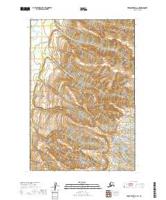
2019 Map of Mount Katmai D-1 NE
USGS Topo · Published 2019About this map
Katmai National Park encompasses nearly the entire landscape shown in this 2019 survey of the Kenai Peninsula. The terrain is defined by high-elevation ridges and glacial valleys, with the northern reaches of the quadrangle draining into the Kamishak River. Located in a remote sector of the Alaska Peninsula, the map provides a look at the wilderness before any established road networks or permanent settlements reached this specific interior pocket. Modern surveying data includes Public Land Survey System township boundaries such as t14s r29w and t15s r29w, which offer fixed reference points for researchers studying the geography of this protected wilderness area.
Find a feature on this map
6 named features on this map. Tap any name to fly to it.
Don’t see what you’re looking for? This feature index may not catch every label — zoom into the map to look around manually.
Map Details
Editions of this 2019 Mount Katmai D-1 NE Map
This is the sole edition of this map. No revisions or reprints were ever made.
Other maps of this area

1948 · Mt Katmai
USGS Topo · 1:250,000

1951 · Mt Katmai
USGS Topo · 1:250,000

1951 · Iliamna A-4
USGS Topo · 1:63,360

1951 · Mount Katmai D-1
USGS Topo · 1:63,360

1951 · Iliamna A-3
USGS Topo · 1:63,360

1951 · Afognak D-6
USGS Topo · 1:63,360

1952 · Iliamna
USGS Topo · 1:250,000

1952 · Afognak
USGS Topo · 1:250,000

1952 · Iliamna A-4
USGS Topo · 1:63,360
1953 · Mount Katmai D-1
USGS Topo · 1:63,360