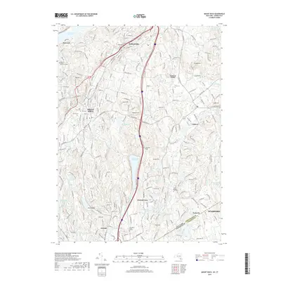
2019 Map of Mount Kisco
USGS Topo · Published 2019About this map
Byram Lake Reservoir and the Kisco River watershed anchor this detailed portrait of Westchester County and the Connecticut borderlands. The landscape is defined by its many water bodies, from the sprawling New Croton Reservoir to the south-flowing Mianus River. Significant local history is preserved in its burial sites, including the Old Quaker Burial Ground and Middle Patent Rural Cem. The map reveals the modern infrastructure of the Saw Mill River Pkwy as it navigates the terrain between Bedford Hills and Mount Kisco. Genealogists will find interest in named landmarks like Bull Hill and Mt Aspetong, while the inclusion of the Yeshiva of Nitra Rabbinical College reflects the cultural continuity of the region. The map also delineates the precise boundary between Westchester Co and Fairfield Co near the settlement of Banksville.
Find a feature on this map
68 named features on this map. Tap any name to fly to it.
Don’t see what you’re looking for? This feature index may not catch every label — zoom into the map to look around manually.
Map Details
Editions of this 2019 Mount Kisco Map
This is the sole edition of this map. No revisions or reprints were ever made.
Other maps of this area

1892 · Stamford
USGS Topo · 1:62,500

1892 · West Point
USGS Topo · 1:62,500

1892 · Carmel
USGS Topo · 1:62,500

1892 · Tarrytown
USGS Topo · 1:62,500

1893 · Carmel
USGS Topo · 1:62,500

1893 · Stamford
USGS Topo · 1:62,500

1893 · Tarrytown
USGS Topo · 1:62,500

1894 · West Point
USGS Topo · 1:62,500

1894 · Carmel
USGS Topo · 1:62,500

1899 · Stamford
USGS Topo · 1:62,500