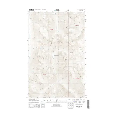
2014 Map of Mount Lago
USGS Topo · Published 2014About this map
Okanogan National Forest dominates this high-altitude landscape, where the crests of the Cascade Range define a complex drainage system. Steep ridgelines connect prominent summits like Mount Lago and Ptarmigan Peak, while glacial basins hold isolated water bodies including Lake of the Woods and Ferguson Lake. The map reveals the intricate headwaters of the Middle Fork Pasayten River and Eureka Cr, illustrating how the terrain dictates the flow of water across these protected federal lands. Notable passes such as Shellrock Pass and Butte Pass provide the only navigable breaks in the wall of peaks that includes Mountain Carru and Osceola Peak. This topographic study provides a detailed record of the wilderness boundary between T38N and T39N, showing the high-country environment of northern Washington as it existed in the early 21st century.
Find a feature on this map
34 named features on this map. Tap any name to fly to it.
Don’t see what you’re looking for? This feature index may not catch every label — zoom into the map to look around manually.
Map Details
Editions of this 2014 Mount Lago Map
This is the sole edition of this map. No revisions or reprints were ever made.
Other maps of this area

1920 · Slate Pass
USGS Topo · 1:125,000

1955 · Concrete
USGS Topo · 1:250,000

1958 · Concrete
USGS Topo · 1:250,000

1962 · Concrete
USGS Topo · 1:250,000

1962 · Mazama
USGS Topo · 1:62,500

1963 · Slate Peak
USGS Topo · 1:24,000
1963 · Robinson Mtn.
USGS Topo · 1:24,000

1969 · Frosty Creek
USGS Topo · 1:24,000

1969 · Lost Peak
USGS Topo · 1:24,000
1969 · Pasayten Peak
USGS Topo · 1:24,000