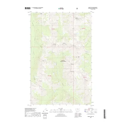
2020 Map of Mount Lago
USGS Topo · Published 2020About this map
Okanogan National Forest encompasses this high-elevation landscape, dominated by the massive presence of Mt Lago and Monument Peak. The terrain is defined by a dense network of alpine water bodies and drainage systems, where the Middle Fork Pasayten River is fed by various tributaries like Robinson Creek and Eureka Creek. This area of the North Cascades shows a high concentration of named summits and ridgelines, from Ptarmigan Peak in the north to Wildcat Mtn in the south, suggesting a topography of sharp relief and complex glacial basins. Several high-altitude lakes, including Lake Doris, Freds Lake, and the remote Ferguson Lake, are tucked into these cirques. The presence of Shellrock Pass and Butte Pass indicates the traditional routes used to navigate these steep divides between the Pasayten and Monument Creek watersheds.
Find a feature on this map
36 named features on this map. Tap any name to fly to it.
Don’t see what you’re looking for? This feature index may not catch every label — zoom into the map to look around manually.
Map Details
Editions of this 2020 Mount Lago Map
This is the sole edition of this map. No revisions or reprints were ever made.
Other maps of this area

1920 · Slate Pass
USGS Topo · 1:125,000

1955 · Concrete
USGS Topo · 1:250,000

1958 · Concrete
USGS Topo · 1:250,000

1962 · Concrete
USGS Topo · 1:250,000

1962 · Mazama
USGS Topo · 1:62,500

1963 · Slate Peak
USGS Topo · 1:24,000
1963 · Robinson Mtn.
USGS Topo · 1:24,000

1969 · Frosty Creek
USGS Topo · 1:24,000

1969 · Lost Peak
USGS Topo · 1:24,000
1969 · Pasayten Peak
USGS Topo · 1:24,000