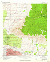
1957 Map of Mount Lemmon
USGS Topo · Published 1962About this map
Tucson pushes northward toward the Santa Catalina foothills in the late 1950s, revealing a landscape defined by rapid mid-century growth and specialized mountain enclaves. The northern edge of the city is a dense network of suburban development and institutions, including the University of Arizona Farm and the historic site of Ft Lowell. Education is a major presence, with diverse campuses ranging from the Academy of the Sacred Heart to the Arizona Desert School.
Find a feature on this map
105 named features on this map. Tap any name to fly to it.
Don’t see what you’re looking for? This feature index may not catch every label — zoom into the map to look around manually.
Map Details
Editions of this 1957 Mount Lemmon Map
3 editions found
Other maps of this area

1904 · Tucson
USGS Topo · 1:125,000

1905 · Tucson
USGS Topo · 1:125,000

1911 · Winkelman
USGS Topo · 1:125,000

1913 · Winkelman
USGS Topo · 1:125,000

1925 · San Xavier
USGS Topo · 1:62,500

1934 · Tucson Mountains
USGS Topo · 1:125,000

1934 · Newman Peak
USGS Topo · 1:125,000

1943 · San Xavier Mission
USGS Topo · 1:62,500

1947 · Cortaro
USGS Topo · 1:62,500

1948 · Tucson
USGS Topo · 1:62,500