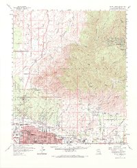
1957 Map of Mount Lemmon
USGS Topo · Published 1967About this map
Tucson pushes northward against the dramatic rise of the Santa Catalina Mountains in this mid-century survey. The urban-wildland interface is clearly defined where the grid of city streets like Grant Road and Prince Rd give way to the rugged canyons and ridges of the Coronado National Forest. Historic educational and religious institutions such as the Academy of the Sacred Heart and the Immaculate Heart Novitiate occupy large tracts near the base of the mountains, while the sprawling University of Arizona Farm sits alongside the Rillito River.
Find a feature on this map
93 named features on this map. Tap any name to fly to it.
Don’t see what you’re looking for? This feature index may not catch every label — zoom into the map to look around manually.
Map Details
Editions of this 1957 Mount Lemmon Map
3 editions found
Other maps of this area

1904 · Tucson
USGS Topo · 1:125,000

1905 · Tucson
USGS Topo · 1:125,000

1911 · Winkelman
USGS Topo · 1:125,000

1913 · Winkelman
USGS Topo · 1:125,000

1925 · San Xavier
USGS Topo · 1:62,500

1934 · Tucson Mountains
USGS Topo · 1:125,000

1934 · Newman Peak
USGS Topo · 1:125,000

1943 · San Xavier Mission
USGS Topo · 1:62,500

1947 · Cortaro
USGS Topo · 1:62,500

1948 · Tucson
USGS Topo · 1:62,500