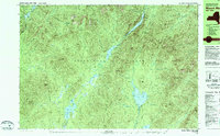
1979 Map of Mount Marcy
USGS Topo · Published 1979About this map
Mt Marcy stands as the central focal point in this 1970s survey of the High Peaks region, where high-altitude water sources like Lake Tear of the Clouds feed the headwaters of the Opalescent River. The landscape is defined by its network of backcountry infrastructure, including numerous shelters, a Ranger Station, and a Heliport near Lake Colden. In the eastern half, the long, narrow corridor of Upper Ausable Lake and Lower Ausable Lake is flanked by steep ridgelines such as the Mt Colvin and the Sawteeth. To the south, the terrain shifts toward lower elevations around Elk Lake and the Boreas Ponds, where points like Marcy Landing and Wagon Wheel Landing indicate established access points. Significant trail networks, such as the Guide Board Trail and a portage marked as The Carry, illustrate the movement of travelers through this wilderness before modern development altered these traditional routes.
Find a feature on this map
107 named features on this map. Tap any name to fly to it.
Don’t see what you’re looking for? This feature index may not catch every label — zoom into the map to look around manually.
Map Details
Editions of this 1979 Mount Marcy Map
This is the sole edition of this map. No revisions or reprints were ever made.
Other maps of this area

1894 · Elizabethtown
USGS Topo · 1:62,500

1895 · Elizabethtown
USGS Topo · 1:62,500

1895 · Mt. Marcy
USGS Topo · 1:62,500

1895 · Paradox Lake
USGS Topo · 1:62,500

1897 · Paradox Lake
USGS Topo · 1:62,500

1897 · Schroon Lake
USGS Topo · 1:62,500

1898 · Newcomb
USGS Topo · 1:62,500

1901 · Newcomb
USGS Topo · 1:62,500

1901 · Elizabethtown
USGS Topo · 1:62,500

1902 · Mt. Marcy
USGS Topo · 1:62,500