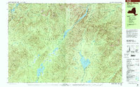
1999 Map of Mount Marcy
USGS Topo · Published 2001About this map
Mt Marcy stands at the heart of this high-elevation landscape within the Adirondack Park, where alpine lakes and narrow passes dictate the movement of travelers. The mapping shows a complex network of glacial features, from the headwaters at Tear of the Clouds to the expansive waters of Upper Ausable Lake and Lower Ausable Lake. The absence of developed roads highlights a wilderness area preserved for recreation, with the Van Hoevenberg Trail and Phelps Trail providing the primary access to the peaks.
Find a feature on this map
116 named features on this map. Tap any name to fly to it.
Don’t see what you’re looking for? This feature index may not catch every label — zoom into the map to look around manually.
Map Details
Editions of this 1999 Mount Marcy Map
This is the sole edition of this map. No revisions or reprints were ever made.
Other maps of this area

1894 · Elizabethtown
USGS Topo · 1:62,500

1895 · Elizabethtown
USGS Topo · 1:62,500

1895 · Mt. Marcy
USGS Topo · 1:62,500

1895 · Paradox Lake
USGS Topo · 1:62,500

1897 · Paradox Lake
USGS Topo · 1:62,500

1897 · Schroon Lake
USGS Topo · 1:62,500

1898 · Newcomb
USGS Topo · 1:62,500

1901 · Newcomb
USGS Topo · 1:62,500

1901 · Elizabethtown
USGS Topo · 1:62,500

1902 · Mt. Marcy
USGS Topo · 1:62,500