
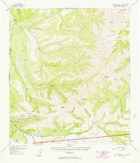
1952 Map of Mount McKinley C-2
USGS Topo · Published 1958About this map
Kantishna and the rugged Kantishna Hills define this interior Alaskan landscape during the mid-1950s. The region is marked by active resource extraction, evidenced by numerous Placer Mines and specific operations like the Red Top Mine and Little Annie Mine. Human presence is concentrated around the gold-bearing drainages of Moose Creek and Eureka Creek, where scattered cabins and the establishment of Camp Denali suggest a transition between industrial mining and early park tourism. High-elevation landmarks such as Quigley Ridge and Wickersham Dome overlook a network of primitive transport routes, including the Caribou Trail, a Jeep Trail, and a Tractor Trail. The southern portion of the map is dominated by the Mt McKinley National Park boundary, with the Denali Highway providing the primary access through the Upper Canyon.
Find a feature on this map
57 named features on this map. Tap any name to fly to it.
Don’t see what you’re looking for? This feature index may not catch every label — zoom into the map to look around manually.
Map Details
Editions of this 1952 Mount McKinley C-2 Map
2 editions found
Other maps of this area

1951 · Mount McKinley D-1
USGS Topo · 1:63,360

1952 · Mount McKinley
USGS Topo · 1:250,000

1952 · Mount McKinley B-2
USGS Topo · 1:63,360

1952 · Mount McKinley C-3
USGS Topo · 1:63,360

1952 · Mount McKinley B-1
USGS Topo · 1:63,360

1952 · Mount McKinley C-1
USGS Topo · 1:63,360

1952 · Mount McKinley D-3
USGS Topo · 1:63,360

1953 · Mount McKinley B-3
USGS Topo · 1:63,360

1954 · Mount McKinley D-2
USGS Topo · 1:63,360

1954 · Mount McKinley D-1
USGS Topo · 1:63,360