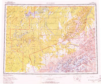
1958 Map of Mount McKinley
USGS Topo · Published 1980About this map
Lake Minchumina serves as a focal point for this expansive interior landscape, where early settlements and the shifting boundaries of Denali National Monument meet. The map documents a time when the Park Road provided a critical artery into the wilderness, reaching landmarks like Stony Hill Overlook and Wonder Lake. To the north, the Kantishna Hills and Diamond suggest the region's mining history, while the vast drainage of the Kuskokwim River and its North Fork dominate the western portion. This cartographic record from the late 1950s captures the transition between territorial development and the formalization of the national park system, including the early designation of the Matanuska-Susitna Borough. Numerous lakes, such as Doghouse Lake and Carlson Lake, pepper the lowlands between the Sischu Mountains and the high peaks of the Alaska Range.
Find a feature on this map
149 named features on this map. Tap any name to fly to it.
Don’t see what you’re looking for? This feature index may not catch every label — zoom into the map to look around manually.
Map Details
Editions of this 1958 Mount McKinley Map
3 editions found

Other maps of this area

1948 · Kantishna River
USGS Topo · 1:250,000

1949 · McGrath
USGS Topo · 1:250,000

1949 · Talkeetna Mountains D-6
USGS Topo · 1:63,360

1949 · Healy A-6
USGS Topo · 1:63,360

1950 · Medfra
USGS Topo · 1:250,000

1950 · McGrath
USGS Topo · 1:250,000

1950 · Talkeetna Mountains
USGS Topo · 1:250,000

1950 · Talkeetna
USGS Topo · 1:250,000

1950 · Fairbanks
USGS Topo · 1:250,000

1951 · Talkeetna
USGS Topo · 1:250,000