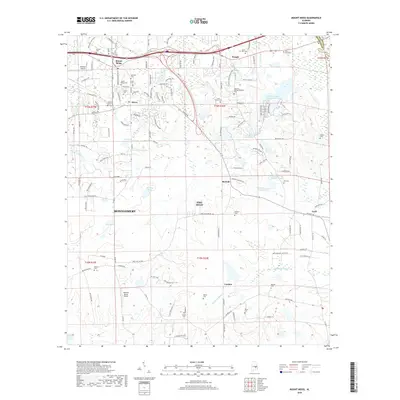
2018 Map of Mount Meigs
USGS Topo · Published 2018About this map
Mount Meigs and the surrounding agricultural landscape of eastern Montgomery County are captured here in the late 2010s. The map illustrates a rural area undergoing transition as suburban development from the west reaches historic crossroads like McDade and Merry. A high density of family and church-affiliated burial grounds, including the Manning Springs/McDade Cem, Lucas Hill Cem, and Antioch Cem, points to the deep generational roots and local heritage of this part of Alabama. The geography is defined by managed water bodies such as Gerald Wallace Lake Number Two and Frank Rutland Lake Number 1, alongside natural drainage features like Mathews Slough. Small aviation facilities, including Kershaw Airport and Bartlett Ranch Airport, serve this region where the city's outskirts meet the open fields and woodlands leading toward Cecil.
Find a feature on this map
151 named features on this map. Tap any name to fly to it.
Don’t see what you’re looking for? This feature index may not catch every label — zoom into the map to look around manually.
Map Details
Editions of this 2018 Mount Meigs Map
This is the sole edition of this map. No revisions or reprints were ever made.
Other maps of this area

1953 · Montgomery
USGS Topo · 1:250,000

1955 · Phenix City
USGS Topo · 1:250,000

1956 · Montgomery
USGS Topo · 1:250,000

1957 · Phenix City
USGS Topo · 1:250,000

1957 · Montgomery
USGS Topo · 1:250,000

1958 · Phenix City
USGS Topo · 1:250,000

1958 · Mount Meigs
USGS Topo · 1:62,500

1971 · Shorter
USGS Topo · 1:24,000
1971 · Fitzpatrick
USGS Topo · 1:24,000

1971 · Davis Crossroads
USGS Topo · 1:24,000