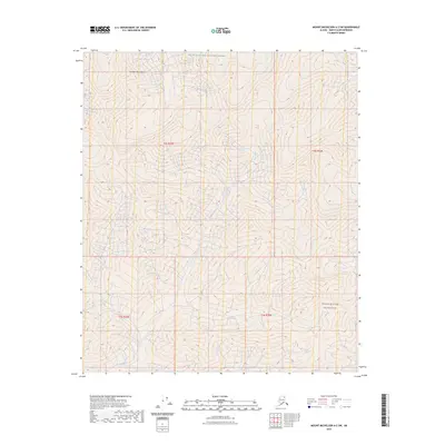
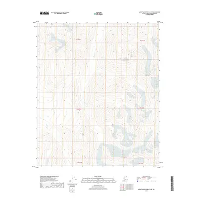
2023 Map of Mount Michelson A-2 SW
USGS Topo · Published 2023About this map
The Franklin Mountains dominate this high-latitude terrain within the Arctic National Wildlife Refuge on the North Slope. The northern reaches of the Mollie Beattie Wilderness extend into the southeastern portion of the map, signifying a landscape preserved in its most primitive state. A defining hydrological feature is the Canning River, which winds across the topography, creating a natural corridor through the steep elevation changes of the Brooks Range foothills. The map reveals an area defined by its lack of human infrastructure, focusing instead on the complex drainage patterns and relief of the land. This survey provides a baseline for understanding the unchanged character of one of North America's most protected environments, where the relationship between the high peaks and the river valley remains dictated entirely by natural forces.
Find a feature on this map
8 named features on this map. Tap any name to fly to it.
Don’t see what you’re looking for? This feature index may not catch every label — zoom into the map to look around manually.
Map Details
Editions of this 2023 Mount Michelson A-2 SW Map
This is the sole edition of this map. No revisions or reprints were ever made.
Other maps of this area

1951 · Arctic
USGS Topo · 1:250,000

1951 · Mt. Michelson
USGS Topo · 1:250,000

1956 · Arctic
USGS Topo · 1:250,000

1956 · Mt. Michelson
USGS Topo · 1:250,000

1983 · Mount Michelson A-3
USGS Topo · 1:63,360

1983 · Mount Michelson A-2
USGS Topo · 1:63,360
1983 · Arctic D-2
USGS Topo · 1:63,360
1983 · Arctic D-3
USGS Topo · 1:63,360
2018 · Arctic D-2 NW
USGS Topo · 1:25,000
2018 · Mount Michelson A-2 NW
USGS Topo · 1:25,000