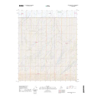
2023 Map of Mount Michelson C-3 NW
USGS Topo · Published 2023About this map
Arctic National Wildlife Refuge lands dominate this northern landscape, showcasing the transition from high mountain slopes down toward the coastal plain. The southern portion of the quadrangle is defined by steep, unnamed peaks and ridges, where narrow drainages begin their northward journey across the tundra. One such feature is the Katakturuk River, which emerges from the southern highlands to flow through the valley in the southeast. A significant portion of this terrain is further protected as the Mollie Beattie Wilderness, preserving a vast stretch of uninhabited territory in the Brooks Range foothills. The map illustrates the intricate braiding of mountain streams and the complex land divisions of the Public Land Survey System, including t4n r26e and t5n r26e.
Find a feature on this map
10 named features on this map. Tap any name to fly to it.
Don’t see what you’re looking for? This feature index may not catch every label — zoom into the map to look around manually.
Map Details
Editions of this 2023 Mount Michelson C-3 NW Map
This is the sole edition of this map. No revisions or reprints were ever made.
Other maps of this area

1951 · Mt. Michelson
USGS Topo · 1:250,000

1955 · Mount Michelson C-3
USGS Topo · 1:63,360

1955 · Mount Michelson D-3
USGS Topo · 1:63,360

1955 · Mount Michelson C-4
USGS Topo · 1:63,360

1955 · Mount Michelson D-4
USGS Topo · 1:63,360

1956 · Mt. Michelson
USGS Topo · 1:250,000

1975 · Mount Michelson C-3
USGS Topo · 1:63,360

1978 · Mount Michelson C-4
USGS Topo · 1:63,360
2018 · Mount Michelson C-3 SE
USGS Topo · 1:25,000
2018 · Mount Michelson C-4 SE
USGS Topo · 1:25,000