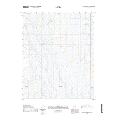
2023 Map of Mount Michelson D-3 NW
USGS Topo · Published 2023About this map
The Tamayariak River flows through this remote stretch of the North Slope, weaving across a landscape defined by expansive wetlands and braided channels. This 2023 survey documents a significant portion of the Arctic National Wildlife Refuge, showcasing the preservation of one of the most untouched ecosystems in the United States. The topography is characterized by the low-lying coastal plain where seasonal water patterns dictate the geography. The map reveals the intricate network of the river system as it moves north toward the Beaufort Sea, providing a detailed look at the drainage patterns and environmental boundaries within the refuge. Unlike more developed regions, the area is devoid of roads or permanent settlements, emphasizing the wilderness character of the Arctic National Wildlife Refuge and its role as a vital habitat.
Find a feature on this map
11 named features on this map. Tap any name to fly to it.
Don’t see what you’re looking for? This feature index may not catch every label — zoom into the map to look around manually.
Map Details
Editions of this 2023 Mount Michelson D-3 NW Map
This is the sole edition of this map. No revisions or reprints were ever made.
Other maps of this area

1951 · Mt. Michelson
USGS Topo · 1:250,000

1955 · Flaxman Island
USGS Topo · 1:250,000

1955 · Mount Michelson D-3
USGS Topo · 1:63,360

1955 · Mount Michelson D-4
USGS Topo · 1:63,360

1955 · Flaxman Island A-4
USGS Topo · 1:63,360

1955 · Flaxman Island A-3
USGS Topo · 1:63,360

1956 · Mt. Michelson
USGS Topo · 1:250,000
1962 · Flaxman Island A-4
USGS Topo · 1:50,000
2018 · Flaxman Island A-4 SE
USGS Topo · 1:25,000
2018 · Flaxman Island A-3 SW
USGS Topo · 1:25,000