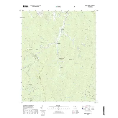
2019 Map of Mount Mitchell
USGS Topo · Published 2019About this map
Pensacola and Murchison sit along the upper reaches of the Cane River in the heart of Pisgah National Forest. This 2019 survey captures the drainage patterns of the Black Mountains, where water flows from the high Black Mtn Crest down through Cattail Cr and Mitchell Cr. For local historians and genealogists, the map identifies several family-named burial sites including the Ray Cem, Allen Cem, and Burleson Cem. The topography is defined by significant gaps and notches, such as Ivy Gap and Cane River Gap, which have historically dictated transit routes through these steep elevations. At the southeastern edge, the map identifies the high-altitude surroundings of Mt Mitchell, including Commissary Ridge and the Mts-Mountains to Sea Trail, documenting the transition from valley settlements to the highest peaks of the range.
Find a feature on this map
88 named features on this map. Tap any name to fly to it.
Don’t see what you’re looking for? This feature index may not catch every label — zoom into the map to look around manually.
Map Details
Editions of this 2019 Mount Mitchell Map
This is the sole edition of this map. No revisions or reprints were ever made.
Other maps of this area

1900 · Mount Mitchell
USGS Topo · 1:125,000

1902 · Mount Mitchell
USGS Topo · 1:125,000

1934 · Micaville
USGS Topo · 1:24,000

1934 · Parts Of Celo And Black Brothers
USGS Topo · 1:24,000

1934 · Parts Of Old Fort and Montreat
USGS Topo · 1:24,000

1935 · Montreat
USGS Topo · 1:24,000

1935 · Black Brothers
USGS Topo · 1:24,000

1935 · Burnsville
USGS Topo · 1:24,000

1935 · Bald Creek
USGS Topo · 1:24,000

1935 · Barnardsville
USGS Topo · 1:24,000