
1943 Map of Mount Morris
USGS Topo · Published 1943About this map
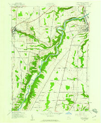
The Genesee River snakes through the heart of this mid-century landscape, carving deep relief into the terrain of western New York. This 1943 mapping, based on aerial photography from the previous year, highlights the steep-walled gorge of Letchworth State Park along the southwestern edge of the quadrangle. The physical geography here dictates the movement of people and commerce, with the Pennsylvania railroad line following the contours of the valley floor while the road networks concentrate on the plateaus above. The village of Mount Morris serves as a primary hub in the northeast, while to the west, the eastern limits of Perry are visible near the Silver Lake Outlet. Smaller rural settlements like Brooks Grove, Ridge, and Simmons Corners are scattered across the agricultural landscape, joined by numerous unnamed farmsteads and rural cemeteries that indicate the deep-seated residential patterns of the Genesee Valley region.
Find a feature on this map
23 named features on this map. Tap any name to fly to it.
Don’t see what you’re looking for? This feature index may not catch every label — zoom into the map to look around manually.
Map Details
Editions of this 1943 Mount Morris Map
2 editions found
Other maps of this area

1904 · Batavia
USGS Topo · 1:62,500

1904 · Caledonia
USGS Topo · 1:62,500

1905 · Portage
USGS Topo · 1:62,500

1905 · Nunda
USGS Topo · 1:62,500

1943 · Sonyea
USGS Topo · 1:24,000

1943 · Nunda
USGS Topo · 1:24,000

1943 · Ossian
USGS Topo · 1:24,000

1943 · Castile
USGS Topo · 1:24,000

1943 · Portageville
USGS Topo · 1:24,000
1944 · Sonyea
USGS Topo · 1:31,680