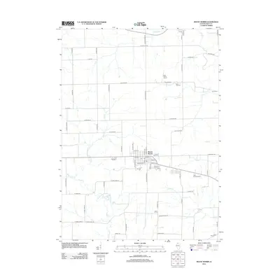
2012 Map of Mount Morris
USGS Topo · Published 2012About this map
Mount Morris serves as the central hub of this Ogle County landscape, where a dense residential grid meets the expansive agricultural reaches of northern Illinois. The town's layout is well-defined by streets like N Main St and W Brayton Road, with the Post Office situated near the heart of the village. The surrounding countryside is shaped by a network of drainage systems, including Leaf River at the northern edge and the winding paths of Pine Creek and Silver Creek.
Find a feature on this map
69 named features on this map. Tap any name to fly to it.
Don’t see what you’re looking for? This feature index may not catch every label — zoom into the map to look around manually.
Map Details
Editions of this 2012 Mount Morris Map
This is the sole edition of this map. No revisions or reprints were ever made.
Other maps of this area

1918 · Dixon
USGS Topo · 1:62,500

1922 · Oregon
USGS Topo · 1:62,500

1924 · Oregon
USGS Topo · 1:62,500

1930 · Woodsung
USGS Topo · 1:48,000

1942 · Forreston
USGS Topo · 1:62,500

1945 · Forreston
USGS Topo · 1:62,500

1946 · Sterling
USGS Topo · 1:62,500

1948 · Sterling
USGS Topo · 1:62,500

1950 · Dixon
USGS Topo · 1:62,500

1954 · Rockford
USGS Topo · 1:250,000
Featured Places
- Mount Morris, IL
- Leaf River, IL
- Oregon - Nashua Township, IL
- Leaf River Township, IL
- Maryland Township, IL