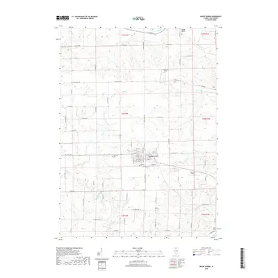
2018 Map of Mount Morris
USGS Topo · Published 2018About this map
Mount Morris serves as the central hub for this portion of Ogle County, showing a detailed street grid including W Main St and W Hitt St. The surrounding landscape is defined by the winding paths of Leaf River and Silver Cr, illustrating the typical drainage patterns of the Illinois prairie. This 2018 survey provides significant data for genealogists, as it identifies numerous burial grounds such as Oakwood Cem, Cedar Hill Cem, and the more remote Camlin Cem. Transportation infrastructure is a mix of traditional township roads like W West Grove Rd and specialized facilities like the Ogle County Airport and West Grove Airport. The mapping of townships like t24n r9e highlights the enduring legacy of the Public Land Survey System in organizing the agricultural and residential development of the region.
Find a feature on this map
79 named features on this map. Tap any name to fly to it.
Don’t see what you’re looking for? This feature index may not catch every label — zoom into the map to look around manually.
Map Details
Editions of this 2018 Mount Morris Map
This is the sole edition of this map. No revisions or reprints were ever made.
Other maps of this area

1918 · Dixon
USGS Topo · 1:62,500

1922 · Oregon
USGS Topo · 1:62,500

1924 · Oregon
USGS Topo · 1:62,500

1930 · Woodsung
USGS Topo · 1:48,000

1942 · Forreston
USGS Topo · 1:62,500

1945 · Forreston
USGS Topo · 1:62,500

1946 · Sterling
USGS Topo · 1:62,500

1948 · Sterling
USGS Topo · 1:62,500

1950 · Dixon
USGS Topo · 1:62,500

1954 · Rockford
USGS Topo · 1:250,000
Featured Places
- Mount Morris, IL
- Leaf River, IL
- Oregon - Nashua Township, IL
- Leaf River Township, IL
- Maryland Township, IL