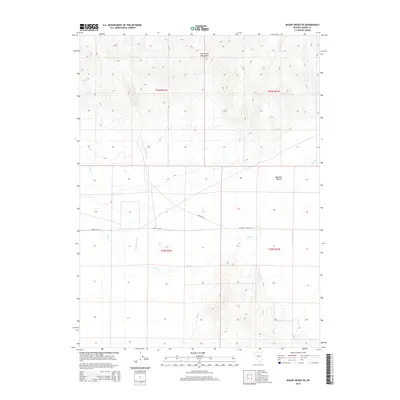
2014 Map of Mount Moses SE
USGS Topo · Published 2014About this map
Brides Wells stands as a focal point of human activity in this high-desert landscape of Lander County, situated where the northern edge of Antelope Valley meets the rising elevations of the Fish Creek Mountains. This 2014 survey captures a terrain defined by seasonal water flow and vast open spaces, typical of the Great Basin's drainage patterns. The ephemeral waters of Cain Cr and Cottonwood Cr carve through the basin, illustrating the critical role of water sources in an arid environment. The map details the transition from the rugged mountain slopes in the north to the flatter expanses of the valley floor, where Antelope Valley Rd provides the primary transit route through this sparsely populated territory. The Public Land Survey System grids for Townships 25 and 26 North indicate the formal organization of this remote Nevada interior.
Find a feature on this map
11 named features on this map. Tap any name to fly to it.
Don’t see what you’re looking for? This feature index may not catch every label — zoom into the map to look around manually.
Map Details
Editions of this 2014 Mount Moses SE Map
This is the sole edition of this map. No revisions or reprints were ever made.
Other maps of this area

1932 · Sonoma Range
USGS Topo · 1:250,000

1939 · Sonoma Range
USGS Topo · 1:250,000

1955 · Millett
USGS Topo · 1:250,000

1955 · Winnemucca
USGS Topo · 1:250,000

1958 · Winnemucca
USGS Topo · 1:250,000

1959 · Millett
USGS Topo · 1:250,000

1961 · The Cedars
USGS Topo · 1:62,500

1961 · Mt. Moses
USGS Topo · 1:62,500

1962 · Winnemucca
USGS Topo · 1:250,000
1969 · Manhattan Mtn NW
USGS Topo · 1:24,000