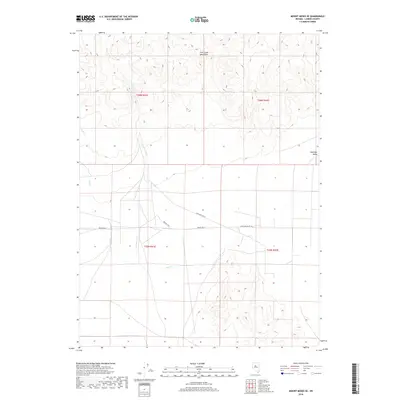
2018 Map of Mount Moses SE
USGS Topo · Published 2018About this map
Fish Creek Mountains dominate the northern landscape of this Lander County region, their high ridges overlooking the broad expanse of Antelope Valley to the south. The arid character of the basin-and-range terrain is defined by its scarce water sources, where ephemeral drainages like Cottonwood Cr and Cain Cr navigate the alluvial fans. Human presence is sparse and centered on vital water points, such as the remote settlement at Brides Wells and the nearby Bridges Well. These locations, connected by the unpaved Antelope Valley Rd, represent the essential infrastructure of a high-desert ranching economy. The map's grid-based land management is evident through the Township and Range boundaries, including t26n r41e and t25n r42e, which delineate the vast public and private land parcels typical of central Nevada's interior.
Find a feature on this map
11 named features on this map. Tap any name to fly to it.
Don’t see what you’re looking for? This feature index may not catch every label — zoom into the map to look around manually.
Map Details
Editions of this 2018 Mount Moses SE Map
This is the sole edition of this map. No revisions or reprints were ever made.
Other maps of this area

1932 · Sonoma Range
USGS Topo · 1:250,000

1939 · Sonoma Range
USGS Topo · 1:250,000

1955 · Millett
USGS Topo · 1:250,000

1955 · Winnemucca
USGS Topo · 1:250,000

1958 · Winnemucca
USGS Topo · 1:250,000

1959 · Millett
USGS Topo · 1:250,000

1961 · The Cedars
USGS Topo · 1:62,500

1961 · Mt. Moses
USGS Topo · 1:62,500

1962 · Winnemucca
USGS Topo · 1:250,000
1969 · Manhattan Mtn NW
USGS Topo · 1:24,000