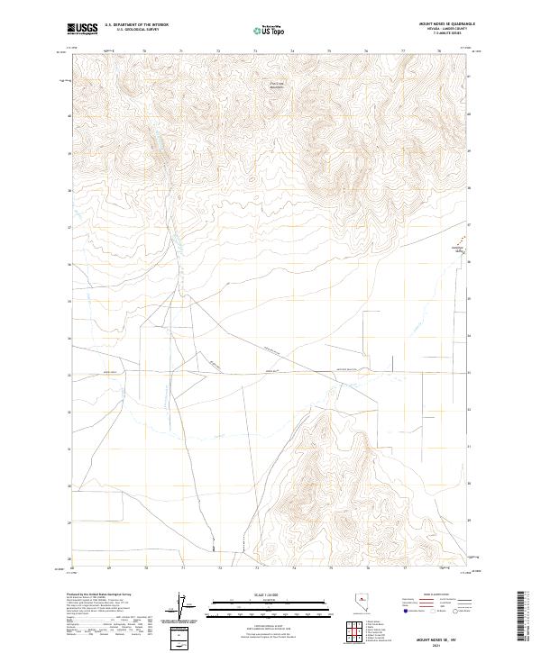
2021 Map of Mount Moses SE
USGS Topo · Published 2021About this map
Fish Creek Mountains rise in the northern reaches of this central Nevada landscape, overlooking the wide expanse of Antelope Valley. The terrain is defined by the drainage patterns of Cain Cr and Cottonwood Cr, which cut through the high desert floor. Human presence in this arid environment is tied closely to water sources and livestock travel, as evidenced by landmarks such as Brides Wells and Bridges Well. The Public Land Survey System grid organizes the township lines of t26n r41e and t26n r42e, illustrating the late-modern parceling of this vast interior. The path of Antelope Valley Rd serves as the primary artery through the basin, connecting these isolated water points across a landscape largely shaped by its topography and intermittent stream beds.
Find a feature on this map
12 named features on this map. Tap any name to fly to it.
Don’t see what you’re looking for? This feature index may not catch every label — zoom into the map to look around manually.
Map Details
Editions of this 2021 Mount Moses SE Map
This is the sole edition of this map. No revisions or reprints were ever made.
Other maps of this area

1932 · Sonoma Range
USGS Topo · 1:250,000

1939 · Sonoma Range
USGS Topo · 1:250,000

1955 · Millett
USGS Topo · 1:250,000

1955 · Winnemucca
USGS Topo · 1:250,000

1958 · Winnemucca
USGS Topo · 1:250,000

1959 · Millett
USGS Topo · 1:250,000

1961 · The Cedars
USGS Topo · 1:62,500

1961 · Mt. Moses
USGS Topo · 1:62,500

1962 · Winnemucca
USGS Topo · 1:250,000
1969 · Manhattan Mtn NW
USGS Topo · 1:24,000