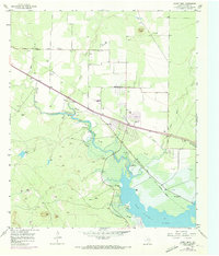
1957 Map of Mount Nebo
USGS Topo · Published 1973About this map
The North Concho River winds through this West Texas landscape, defined by mid-century infrastructure and rural ranching. This period marks a transition in water management, as the San Angelo Lake reservoir and the San Angelo Dam dominate the lower quadrant, with the Spillway and Shore Drive indicating the rise of recreational and civic engineering in Tom Green County. Further north, the small settlement of Carlsbad and the nearby Brown Ranch represent the area's agricultural roots, supported by the Grape Creek-Pulliam Sch and the Grape Creek Cem.
Find a feature on this map
18 named features on this map. Tap any name to fly to it.
Don’t see what you’re looking for? This feature index may not catch every label — zoom into the map to look around manually.
Map Details
Editions of this 1957 Mount Nebo Map

Other maps of this area

1891 · Hayrick
USGS Topo · 1:125,000

1892 · San Angelo
USGS Topo · 1:125,000

1894 · Hayrick
USGS Topo · 1:125,000

1895 · Sherwood
USGS Topo · 1:125,000

1924 · San Angelo 2-b
USGS Topo · 1:48,000

1924 · Sherwood 1-a
USGS Topo · 1:48,000

1928 · Wall
USGS Topo · 1:62,500

1928 · Tankersly
USGS Topo · 1:62,500

1954 · San Angelo
USGS Topo · 1:250,000

1957 · Carlsbad
USGS Topo · 1:62,500