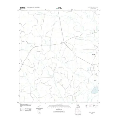
2012 Map of Mount Olive
USGS Topo · Published 2012About this map
Mount Olive and its eponymous Mount Olive Cem serve as the focal point for this rural Bienville Parish landscape. The terrain is defined by a dense network of waterways, including the winding Dugdemona River and its tributary, the Little Dugdemona River, which frame the southeastern corner near Black Pond. This 2012 survey illustrates the modern parish road system, such as Parish Road 834 and Parish Road 153, connecting small communities like New Friendship, English, and Lakefield. The landscape is etched with numerous smaller streams, including Choctaw Cr and Dukedall Cr, suggesting a heavily forested or agricultural environment typical of north-central Louisiana. Genealogists will find particular value in the clearly marked Walnut Ridge Cem near Bear Creek, providing precise locations for local ancestral research.
Find a feature on this map
85 named features on this map. Tap any name to fly to it.
Don’t see what you’re looking for? This feature index may not catch every label — zoom into the map to look around manually.
Map Details
Editions of this 2012 Mount Olive Map
This is the sole edition of this map. No revisions or reprints were ever made.
Other maps of this area

1947 · Goldonna
USGS Topo · 1:62,500

1947 · Bienville
USGS Topo · 1:62,500

1949 · Bienville
USGS Topo · 1:62,500

1949 · Jonesboro
USGS Topo · 1:62,500

1950 · Jonesboro
USGS Topo · 1:62,500

1953 · Hodge
USGS Topo · 1:62,500

1955 · Shreveport
USGS Topo · 1:250,000

1956 · Shreveport
USGS Topo · 1:250,000

1957 · Goldonna
USGS Topo · 1:62,500

1984 · Shreveport
USGS Topo · 1:250,000