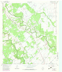
1963 Map of Mount Olive
USGS Topo · Published 1983About this map
The confluence of rural Jackson County industry and ancestral history is visible across this mid-century landscape. The Navidad River and Lavaca River snake through the terrain, defining a region rich in energy extraction, as evidenced by the sprawling Morales Gas Field and Cordele Oil Field. These industrial zones are crisscrossed by numerous pipelines and access routes like Upper Cordele Road and Hill Road, indicating the intensive natural resource development characterizing the area during the early 1960s.
Find a feature on this map
40 named features on this map. Tap any name to fly to it.
Don’t see what you’re looking for? This feature index may not catch every label — zoom into the map to look around manually.
Map Details
Editions of this 1963 Mount Olive Map
2 editions found
Other maps of this area

1951 · Inez
USGS Topo · 1:24,000

1952 · Manson
USGS Topo · 1:24,000

1952 · Edna
USGS Topo · 1:24,000

1953 · Beeville
USGS Topo · 1:250,000

1953 · Seguin
USGS Topo · 1:250,000

1956 · Beeville
USGS Topo · 1:250,000

1958 · Seguin
USGS Topo · 1:250,000

1960 · Beeville
USGS Topo · 1:250,000

1963 · Ganado
USGS Topo · 1:24,000

1963 · Mount Olive
USGS Topo · 1:24,000