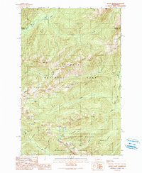
1990 Map of Mount Olson
USGS Topo · Published 1990About this map
Olympic National Park encompasses much of this high-elevation terrain, where the headwaters of the Quinault River and the North Fork Skokomish River originate. The landscape is defined by massive peaks and ridges, including Mount Olson and the sharp profile of O'Neil Peak. Further south, the Wonder Mountain Wilderness sits within the Olympic National Forest, protecting the area around Wonder Mountain. The transition from national park to forest land is clearly marked, illustrating the complex management of these Cascades environments in the late twentieth century.
Find a feature on this map
29 named features on this map. Tap any name to fly to it.
Don’t see what you’re looking for? This feature index may not catch every label — zoom into the map to look around manually.
Map Details
Editions of this 1990 Mount Olson Map
This is the sole edition of this map. No revisions or reprints were ever made.
Other maps of this area

1921 · Satsop
USGS Topo · 1:62,500

1938 · Mt Constance
USGS Topo · 1:125,000

1947 · Mt. Steel
USGS Topo · 1:62,500

1947 · Mt Christie
USGS Topo · 1:62,500

1950 · Mt Christie
USGS Topo · 1:62,500

1950 · Mt. Steel
USGS Topo · 1:62,500

1953 · Mt Tebo
USGS Topo · 1:62,500

1955 · Grisdale
USGS Topo · 1:62,500

1958 · Seattle
USGS Topo · 1:250,000

1962 · Seattle
USGS Topo · 1:250,000