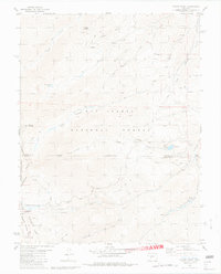
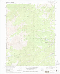
1980 Map of Mount Ouray
USGS Topo · Published 1981About this map
Mount Ouray dominates this high-altitude landscape along the Continental Divide, where the borders of Chaffee, Saguache, and Gunnison counties meet. The map reveals a complex network of resource extraction and transit through the San Isabel National Forest and Gunnison National Forest. Evidence of historical mining activity is scattered across the terrain, notably at the Cinderella Mine and various Prospects near Redman Creek.
Find a feature on this map
47 named features on this map. Tap any name to fly to it.
Don’t see what you’re looking for? This feature index may not catch every label — zoom into the map to look around manually.
Map Details
Editions of this 1980 Mount Ouray Map
5 editions found
Other maps of this area

1940 · Garfield
USGS Topo · 1:62,500

1945 · Garfield
USGS Topo · 1:62,500

1956 · Poncha Springs
USGS Topo · 1:62,500

1956 · Montrose
USGS Topo · 1:250,000

1959 · Montrose
USGS Topo · 1:250,000

1959 · Bonanza
USGS Topo · 1:62,500

1960 · Montrose
USGS Topo · 1:250,000

1967 · Chester
USGS Topo · 1:24,000

1967 · Pahlone Peak
USGS Topo · 1:24,000

1968 · Montrose
USGS Topo · 1:250,000